National IDs around the World: Data Analysis and Graphic
We are highlighting two recent publications from this year, both involving large and important datasets. In case you missed this work, here are the highlights. Click the links below to visit the original interactive data visualizations.
First: National IDs Around the World
This interactive map displays the presence of National IDs and electronic IDs, including biometric IDs, in countries globally. The raw dataset used to create the map data originates from the World Bank (See data sourcing on the original map page). This dataset covers high, middle and lower income countries.
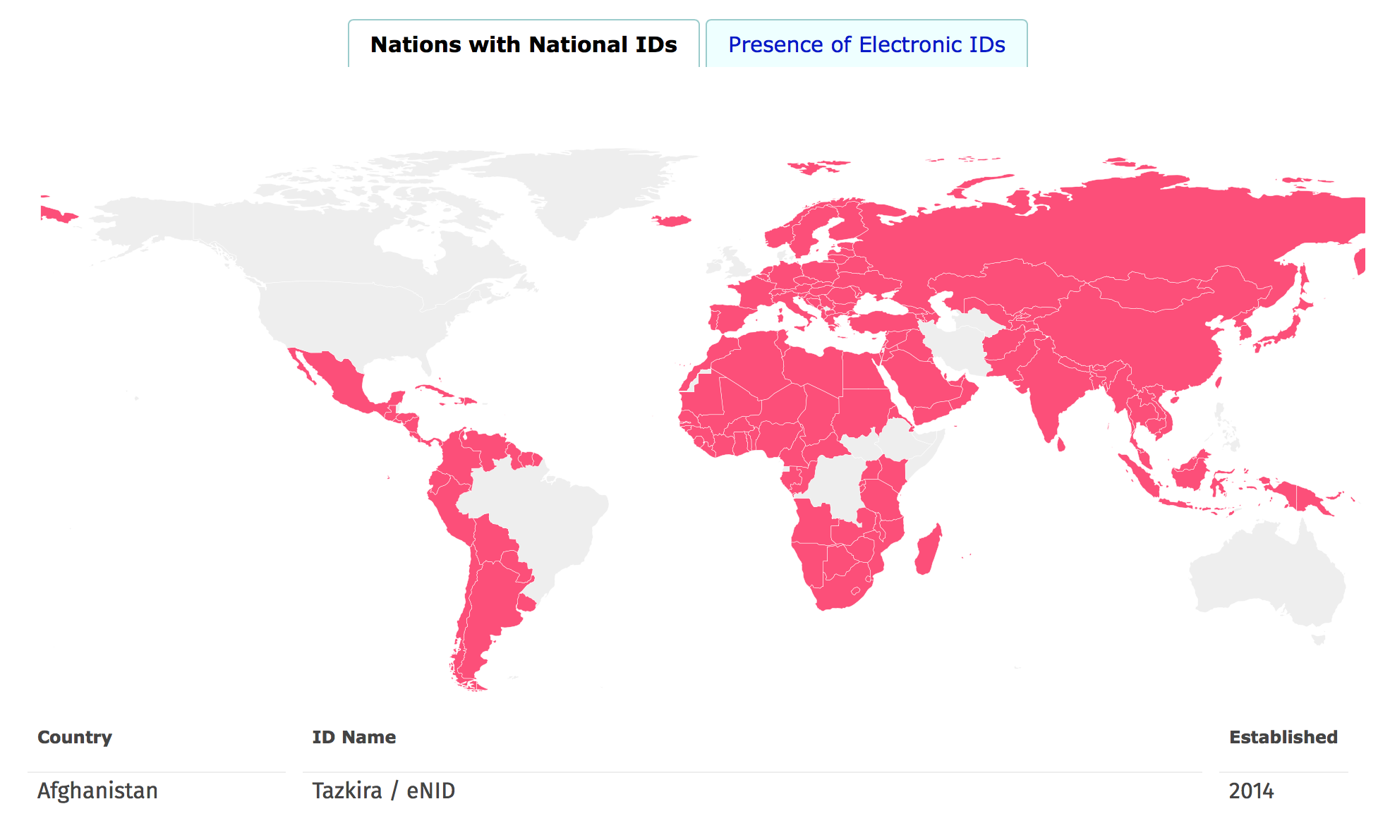
Screenshot of National IDs Around the World
Second: National IDs over time
This interactive chart displays the chronological implementation of National IDs in countries globally, from 1850 to 2017. The raw dataset used to create the chart originates from the World Bank (See data sourcing at the original map page). This dataset covers high, middle and lower income countries.
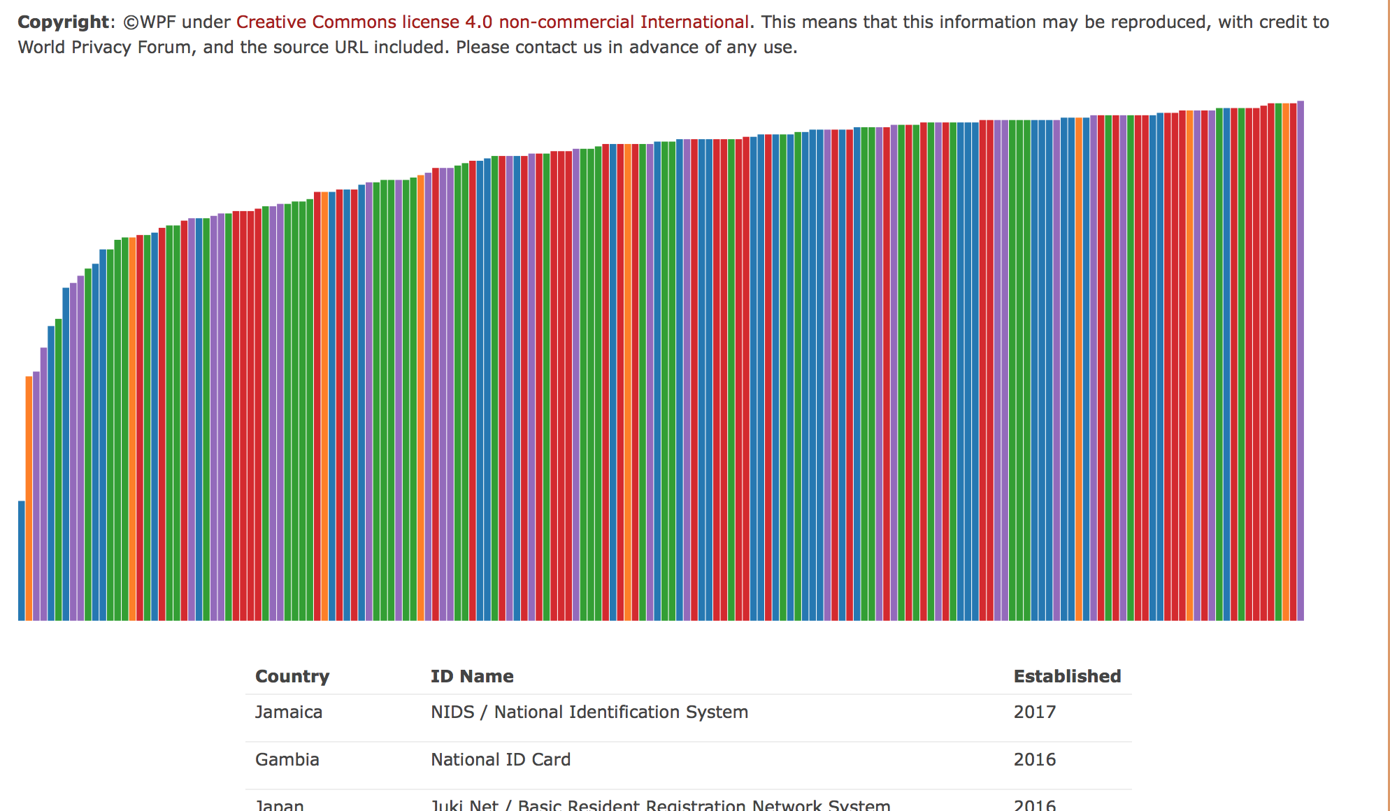
Screenshot of National IDs Over Time